AIS Coastal Monitoring Solution
AIS COASTAL MONITORING is beneficial for monitoring all vessels within the Country Border.
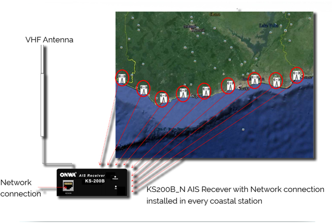
To cover the country border, There will be several coastal stationsand each station will be equipped with an AIS Receiver withnetwork connection (KS-200B_N). The AIS Information of all coastal station are sent to a Control Center through Internet.
Requirements of AIS Coastal Monitoring system:
• AIS Receiver with network connection
• Internet connection on every coastal station
• Control center with fix IP internet service
• VMS software (You can use existing VMS Software or you can also use DIGIMARINE COASTAL monitoring system)

DIGIFENCE COASTAL MONITORING SYSTEM
The DIGIMARINE AIS Monitoring system can be tailor made to any necessary functions of different requirements.:
Features:
- Ship Type Filtering: Search by 197 different ship types (based on Statcode 5 system)
- Ship Track on Map: Visualize up to 30 days ship track
- Ship Watch/Alerts and Zone Services: Use these automated services to track current vessel positions and destination changes. Create your bespoke alert zone to be notified when a ship goes through a specified area.
- Ship Watch/Alerts and Zone Services: Use these automated services to track current vessel positions and destination changes. Create your bespoke alert zone to be notified when a ship goes through a specified area.
- Easy to Navigate: Quickly and intuitively conduct map searches and use interactive charts with ability to zoom in 16 levels
- Distance Tables Module: Calculate a ship’s arrival with greater accuracy
- Real-time Ship Movements: Track ship locations worldwide, 24/7 online
- Verified Ship Data: Find name, technical manager and commercial operator, type, call sign, dimensions and photos
- Ship Search: Locate current or last reported position
- Seamless Connectivity to KS200B_N
- Customize to the requirements of different customer
ADD-ON:
DIGIFENCE AIS COASTAL MONITORING SOFTWARE
Can be integrated to the standard Coastal Monitoring system for customers who want to build AIS tracking monitoring system.
Overview:
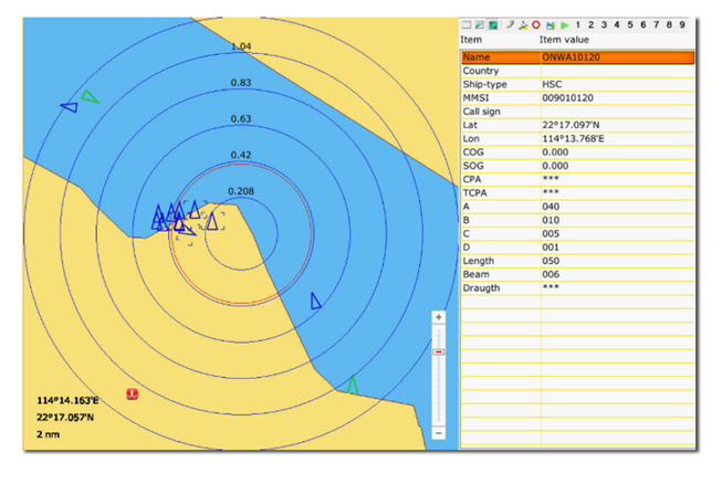
>> Coastal outline background included for a radar style display, with a world-wide coastal database included in the software so that the background is automatically displayed.
>> The ability to log AIS data and to play back data for any chosen period.
>> The ability to handle large numbers of targets at once; tested with 500+ targets!
>> Can mark and track selected AIS targets, max. 20 targets (just like ARPA in radar.)
>> Decode DigiMarine Tracking Group ID and display as vessel symbol with different color other than Class A and Class targets.


